
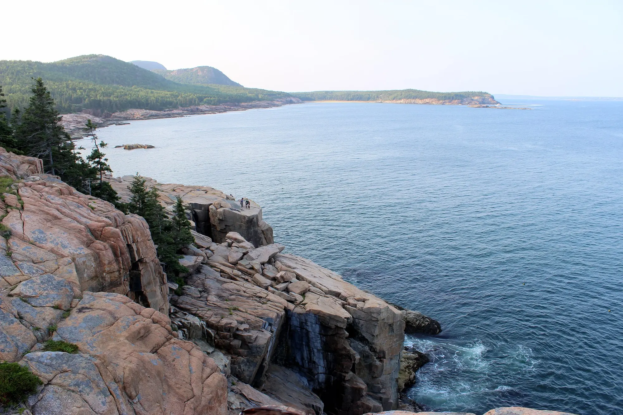

This is the most-walked path in Acadia, and most people walking it are doing a different hike from the one the sign describes.
Two very different walks
“Distance: 2.2 mile traill one way, 4.4 miles round trip. The trail is 0.7 miles from Sand Beach to Thunder Hole.”
(The typo is the Park Service’s, on its Ocean Path page.)
The 1.4-mile round trip to Thunder Hole and back is a flat, largely paved stroll suitable for almost anybody. That is what the great majority of visitors actually do.
The full 4.4-mile round trip to Otter Point is a different proposition — two to four hours, uneven rock, staircases and genuine cliff edges.
Neither is hard. But people set off expecting the first and find themselves in the second, which is where the day goes wrong.
Where the surface changes
“From Sand Beach to Thunder Hole the trail is a mix of concrete and packed gravel surfaces. The rest of the trail is gravelly and rocky with uneven surfaces.”
And at 1.4 miles:
“There are two staircases present 1.4 miles into the trail as the path climbs around a rocky cliff section. Steep drops into the ocean. Keep children away from the edge.”
That is the transition point. Before it, a path. After it, a coastal trail with exposure.
The reward at the far end:
“Arrive at Otter Cliffs, 110-ft cliffs that mark the highest point along the Ocean Path.”
Accessibility, and the parking lot nobody uses
The accessible section is real:
“Ocean Path is accessible from the upper parking lot of Sand Beach to Thunder Hole.”
But how you get to it matters enormously, and the answer is counterintuitive:
“Thunder Hole parking area is the most physically accessible entrance to Ocean Path. There are three accessible parking spots which lead to a ramp, a crosswalk, and the short section of Ocean Path that is paved.”
Whereas Sand Beach, the obvious choice, is the wrong one:
“Sand Beach has five accessible parking spaces in the lower parking lot. A rugged staircase, or steep walk on the road, can be taken to the upper car park where Ocean Path starts.”
So: park at Thunder Hole, not Sand Beach, if accessibility matters. The five accessible spaces at Sand Beach are below a rugged staircase from the trail they appear to serve.
And avoid the third option entirely: “Otter Point parking area has one accessible parking spot, but the trail in this section is more hazardous with roots and larger rocks.”
Thunder Hole, and the two conditions
“Gradually descend on accessible trail to Thunder Hole, an underwater sea cave that with the right conditions (2 hours before high-tide and high winds) can produce thundering crashes heard up and down the trail.”
Both conditions. Two hours before high tide and high winds. Arrive at the wrong point in the tide on a calm day and you have waited in line to look at a slot in the rock. The tide tables are the difference between the best ten minutes on the Loop Road and a shrug — more on that here.
Getting there
“The bus drops off and picks up at regular intervals throughout the day at the Island Explorer sign located in the right lane of Park Loop Road at Thunder Hole, and on the right side of Sand Beach lower parking lot.”
Which is the better plan, because:
“Sand Beach Parking Lot and the right-lane of the Park Loop Road to Otter Point can routinely fill by 9 am during the summer and weekends.”
Two stops, both ends of the walk, on a free bus, against a lot that is full before nine. This is the trail where the Island Explorer most obviously wins.
Out of the bus season you drive to it, and you can all winter. Ocean Drive, the stretch of the Loop Road beside the path from Sand Beach past Thunder Hole, is one of the two sections the Park Service keeps open to cars from 1 December to 14 April, weather permitting, and Ocean Path is one of the walks it suggests for winter. Acadia in winter has the way in from Bar Harbor and what else stays open.
The sunrise the Park Service actually recommends
Almost everyone goes to Cadillac. The park’s own suggestion for Ocean Path:
“Excellent location to watch sunrise and escape the crowds on Cadillac Mountain.”
No reservation, no $6, no 5 a.m. entry window, no line for the summit lot. Sea level, facing east, over the open Atlantic. It is a genuinely better sunrise plan than the famous one for most people, and it is the park recommending it rather than us.
One caveat on closures
The southern end is closed. Since 31 August 2026 the Park Service has closed Ocean Path “from a trailhead across from the Otter Point parking lot to the trail’s southern terminus”, for repairs, and has published no reopening date (park alerts). Sections of the path have taken storm damage before — “Our trail crew, with support from Friends of Acadia, completed temporary repairs at Ocean Path.”
What still works: Thunder Hole is north of the closure, so the Sand Beach to Thunder Hole stretch — the 0.7 miles most people actually walk — is unaffected, and on the park’s own route description Otter Cliffs come before Otter Point. What is shut is the end of the trail: from the Otter Point parking lot, past Otter Point, to Otter Cove.
The Park Service’s own trail page still lists the season as year round and does not mention any of this. The closure is posted on the park’s alerts list, which is the page to check on the morning. We track it on Bar Island and Thunder Hole.


