
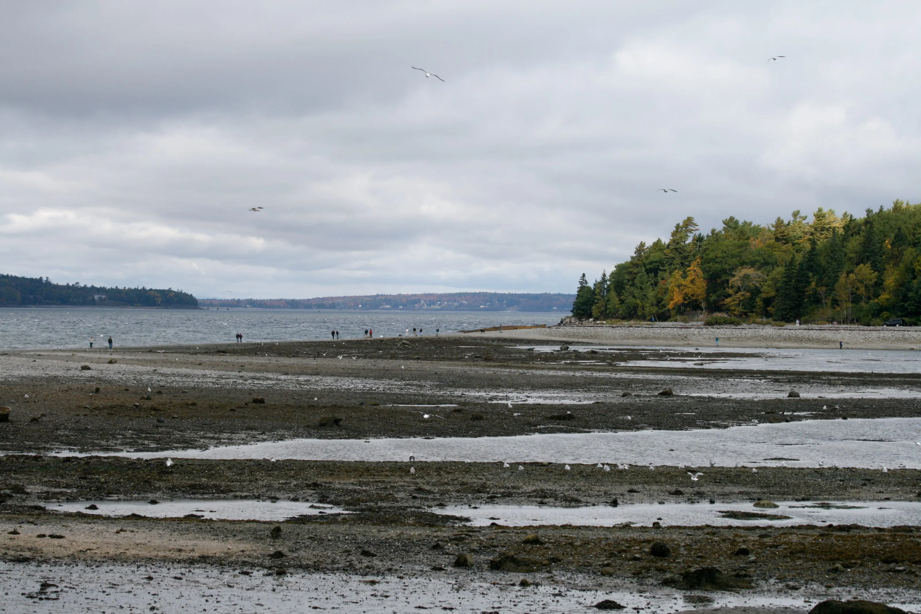
Acadia is a coastal park, and the two places where that becomes a safety problem rather than a view are Bar Island and Thunder Hole. Both run on the tide. They run on opposite ends of it.
Bar Island: a road that exists for three hours
From Bridge Street in downtown Bar Harbor, a gravel bar emerges from Frenchman Bay and connects the town to Bar Island. You walk across it. It is about half a mile of bar, and 1.9 miles round trip with the island trail on the end of it, which NPS allows 45 to 90 minutes for.
The window is 90 minutes before to 90 minutes after low tide. That is the Park Service’s own figure, and it is about three hours a day, twice a day.
Then it closes, and the Park Service is blunt about what that means:
If you lose track of time, it is another nine hours until the bar emerges again to safely walk across.
Nine hours. Not a wet crossing, not a wade: NPS puts Acadia’s tidal range at about 12 feet, and there are two highs and two lows a day. There is nothing on Bar Island — no facilities, no other way off, and no one coming for you on a schedule.
How not to be the one they talk about
- Check the tide the morning you go. The Park Service puts the shift at about 50 minutes every 24 hours, so a time you read last week is wrong. The park points readers at the usharbors.com tide chart for Bar Harbor; NOAA publishes Bar Harbor predictions too.
- Work backwards from the closing edge, not the opening one. Decide the time you must be back on the bar, and treat it as fixed.
- You pay for parking downtown from 15 May to 31 October, and parking is not allowed on the bar or on Bridge Street. In season the Island Explorer is simpler than circling.
- Closed-toe shoes with grip. The bar is pebble and rock, not sand, and the island trail is uneven.
This is the most common way visitors get into trouble in Bar Harbor, and it is entirely avoidable by reading one number before you set off.
Thunder Hole: the other end of the same tide
Thunder Hole is a narrow channel in the granite on Ocean Drive. When a wave compresses the air in it, the air escapes with a bang you can hear from the parking lot.
NPS recommends arriving one to two hours before high tide for the best chance of hearing it. That is the direct opposite of the Bar Island window, so the two cannot be planned for the same hour of the same day — which is worth knowing before you build an itinerary that assumes they can.
What makes it dangerous
The same swell that makes the noise is the hazard:
- Wave sprays here have been seen to reach more than 40 feet.
- The stairway and lower viewing deck are often wet and slippery, and particularly so in winter.
- Even in calm weather, rogue waves can suddenly wash over the surrounding granite ledges and outcrops. That is the sentence to take seriously, because it removes “it looked fine” as a reason to walk out onto the rock.
- During storms, sections of the walkway are closed. A closed sign at Thunder Hole is not a formality.
On 23 August 2009 a single wave swept seven people into the ocean at Thunder Hole. A seven-year-old girl died; eleven people were taken to hospital. The park had already closed Sand Beach and the Thunder Hole viewing platform, posted extra signs, and directed visitors back from the water as high tide approached. The wave was bigger than the precautions.
The big-surf days are the dangerous days and they are also the days everybody comes. If a storm is offshore, watch from behind the railings and stay off the open ledges.
Ocean Path is partly closed right now
Thunder Hole sits on Ocean Path, the walk from Sand Beach down the coast. As of 31 August 2026 the Park Service has closed its southern section for repairs — from the trailhead opposite the Otter Point parking lot to the trail’s southern end.
Thunder Hole is north of that stretch and is reached normally from Sand Beach or from its own lot. The walk through to Otter Point is not currently a plan. The park has not published a reopening date; we are watching it and will log it on what changed when it moves.
The one-line version
Bar Island: go at low tide, and leave on time. Thunder Hole: go before high tide, and stay behind the railing. Everything else about both places is scenery.