
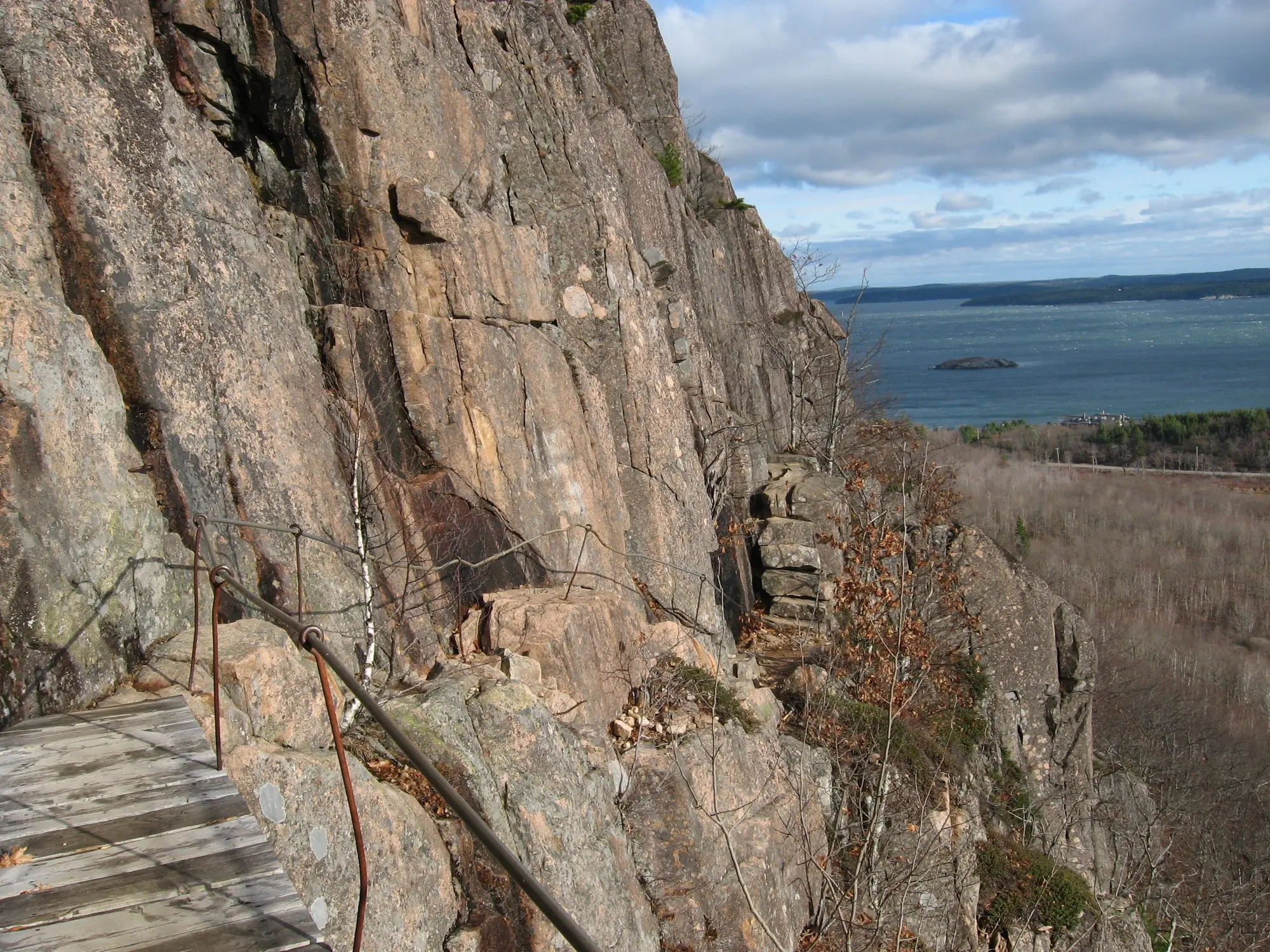

The most serious marked trail in Acadia, and the one where the honest advice is mostly about deciding at the bottom.
Iron rungs and ladders bolted into an exposed cliff, rising over 1,000 feet in 0.9 miles. No rope, no technical skill — and no comfortable way to change your mind once you are on it.
The full loop is 3.2 miles, not the two-ish miles most pages quote. That is because the sanctioned route is a loop and not an out-and-back: up the Precipice, over the summit of Champlain Mountain, down the North Ridge Trail, and back to the parking lot along the Orange and Black Path. NPS allows 2 to 3 hours for it.
The closure that catches people
The Precipice closes for peregrine falcon nesting, usually from spring into summer. The birds nest on the same cliff the rungs are bolted to, so the park shuts the trail rather than disturb them.
The dates move every year because the falcons do not keep a calendar. This is why people drive to the trailhead and find a sign — a blog post from three years ago said it was open in June, and in that year it was.
Check the park’s current conditions the morning you go, not the week before.
Why you decide at the bottom
On most hard trails, turning back is the easy option. Here the Park Service’s Precipice Loop page says it is not one: “Descending the Precipice is dangerous and not advised.”
That is why the route is a loop. You go up the rungs and you come down an ordinary trail on the other side of the mountain, which means the decision is made at the bottom, before you start, and partway up is the worst place to discover the exposure is too much.
The Beehive is the cheap way to find out. Same design — rungs, ledges, drops — at roughly half the height and a third of the commitment. If the Beehive felt fine, the Precipice is a step up you can judge. If it did not, you have learned that for 450 feet instead of 1,000.
Conditions that change the answer
Rain. Wet granite and wet metal rungs turn a serious hike into a bad idea. This is not a trail to do in a drizzle because you drove a long way.
Heat. It faces east and is fully exposed, so it bakes from mid-morning.
Crowds. The rungs are single-file. Being behind a nervous party on a ladder is its own kind of problem, and it is the argument for starting early.
Who the park says should not be on it. NPS does not recommend the Precipice for small children or for anyone with a fear of heights, and pets are not allowed on it because of the rungs, the ladders and the steep sections.
Getting there
The trailhead is on the one-way section of the Park Loop Road, about 2.8 miles in from the Hulls Cove entrance.
There is no bus. The Park Service is explicit: “There is no public transportation to Precipice Trailhead.” This page previously said the Island Explorer served it, which was wrong, and it was wrong in the direction that costs you the morning. Every other trail on this site is better reached by the free bus than by car. This one is not, and the lot is small, so early matters more here than anywhere else in the park.
No reservation is needed for this trail. The Cadillac Summit reservation system covers one road, not the park, and it does not apply here.


